CHI 2025: two papers accepted
We are pleased to share that two of our papers have been accepted for the ACM (Association of Computing Machinery) CHI conference on Human Factors in Computing Systems 2025, the most important international conference in the field of human-computer interaction. CHI 2025 took place in Yokohama, Japan, from 26 April to 1 May 2025.
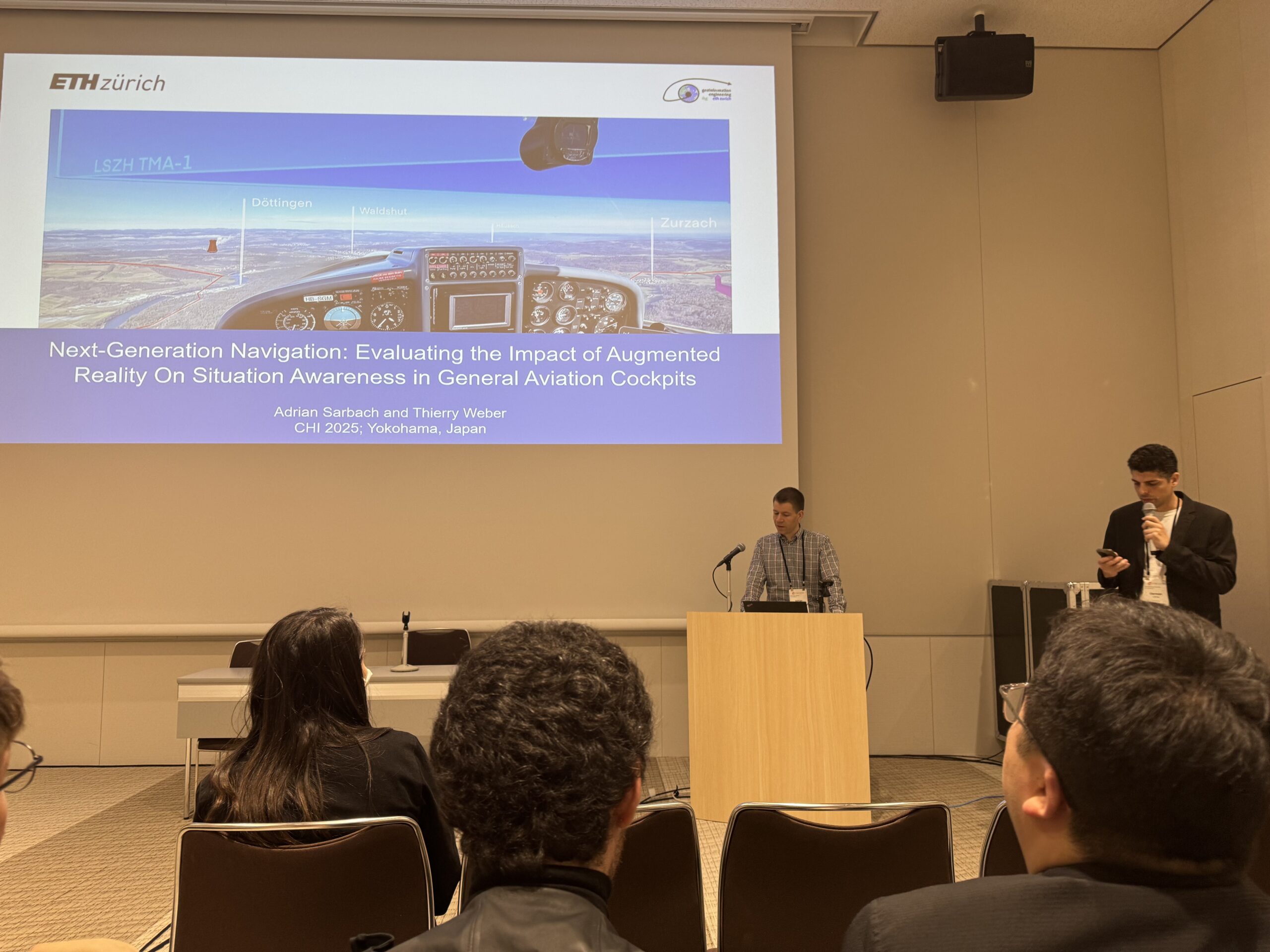
Adrian Sarbach presented his paper with the title “Next-Generation Navigation: Evaluating the Impact of Augmented Reality on Situation Awareness in General Aviation Cockpits“, written together with Thierry Weber. This paper presents findings on how AR technology (tested with the Microsoft HoloLens 2) can help pilots obtain and keep a higher level of situation awareness in the aircraft cockpit.
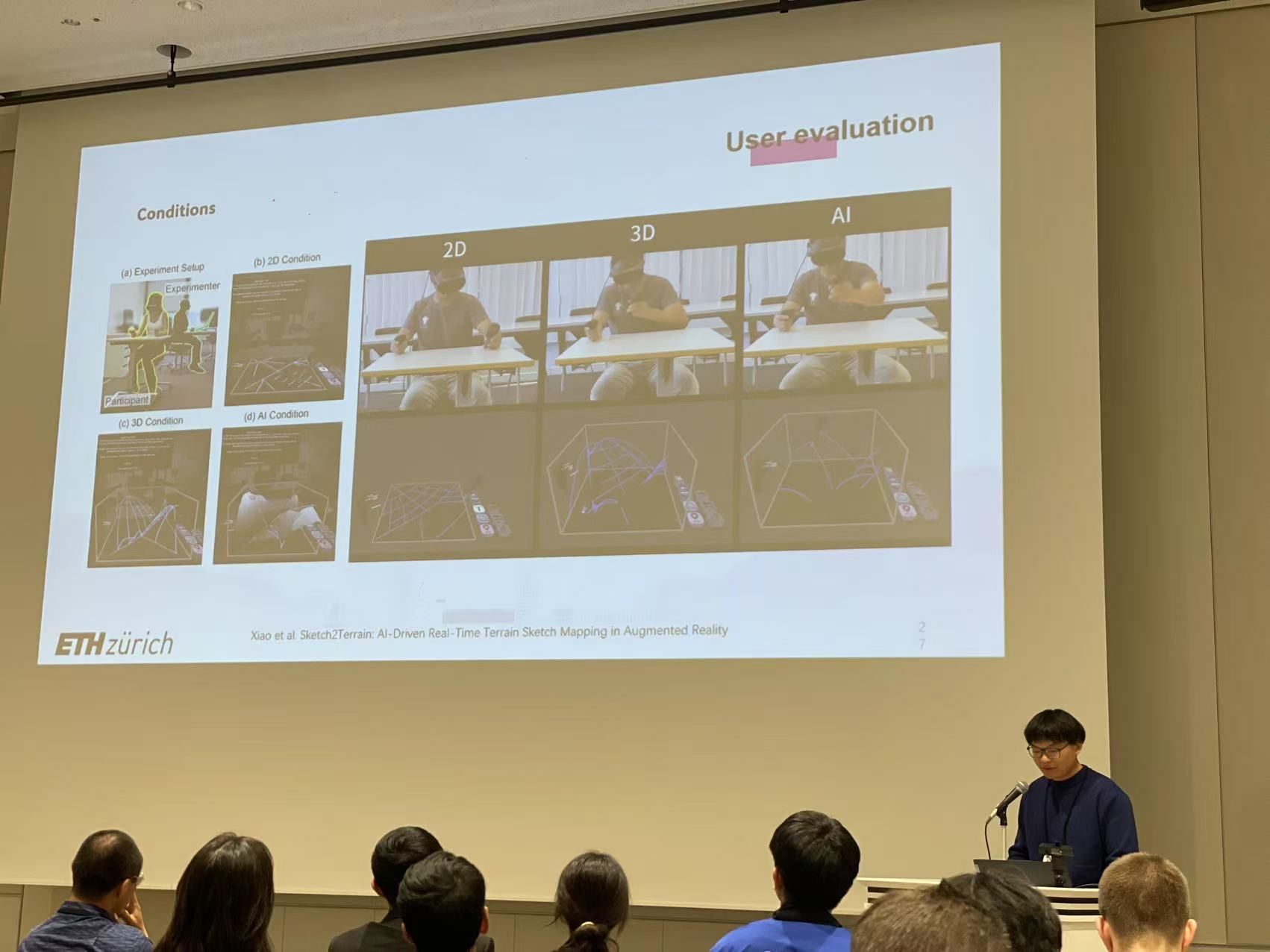
Tianyi Xiao presented his paper with the title “Sketch2Terrain: AI-Driven Real-Time Terrain Sketch Mapping in Augmented Reality“, written together with Yizi Chen, Sailin Zhong, Peter Kiefer, Jakub Krukar, Kevin Gonyop Kim, Lorenz Hurni, Angela Schwering, and Martin Raubal. This paper developed a generative AI model that can help novice mappers externalize complex terrain memory in XR.
Please refer to our paper if you are interested in aviation and 3D sketch mapping in VR/AR technologies!
———-
Here again papers and their respective abstracts
Flights in general aviation require pilots to navigate using 2D maps, which splits their attention between the cockpit and the outside environment, reducing situation awareness. Augmented reality (AR) can bridge the gap between the inside and outside world, and thus can resolve the issue of attention switches. In a mixed methods simulator study with 19 pilots, we tested an AR application that integrated invisible and hard-to-see aeronautical data and navigation features with the visible world. Results show that the AR tool enhances and accelerates orientation, and can result in flight trajectories being more accurate with AR than without AR. Situation awareness, measured with a subjective self-rating, was not increased with AR support. Participants voiced concerns about AR content occluding outside features, while positive feedback included use cases in unfamiliar areas and in low visibility, as well as highlighting of hazards.
Sketch2Terrain: AI-Driven Real-Time Terrain Sketch Mapping in Augmented Reality
Dataset, Open-sourced project page
Sketch mapping is an effective technique to externalize and communicate spatial information. However, it has been limited to 2D mediums, making it difficult to represent 3D information, particularly for terrains with elevation changes. We present Sketch2Terrain, an intuitive generative-3D-sketch-mapping system combining freehand sketching with generative Artificial Intelligence that radically changes sketch map creation and representation using Augmented Reality. Sketch2Terrain empowers non-experts to create unambiguous sketch maps of natural environments and provides a homogeneous interface for researchers to collect data and conduct experiments. A between-subject study (N=36) revealed that generative-3D-sketch-mapping improved efficiency by 38.4%, terrain-topology accuracy by 12.5%, and landmark accuracy by up to 12.1%, with only a 4.7% trade-off in terrain-elevation accuracy compared to freehand 3D-sketch-mapping. Additionally, generative-3D-sketch-mapping reduced perceived strain by 60.5% and stress by 39.5% over 2D-sketch-mapping. These findings underscore potential applications of generative-3D-sketch-mapping for in-depth understanding and accurate representation of vertically complex environments. The implementation is publicly available.